For civil and sitework
Sitework estimating software for earthwork, paving and utilities
Build existing and proposed grade from the plan contours, calculate cut and fill, and measure paving and pipe in the same project. The earthwork lands in the estimate next to everything else on the site.
Start your free trial. No card required.
Earthwork
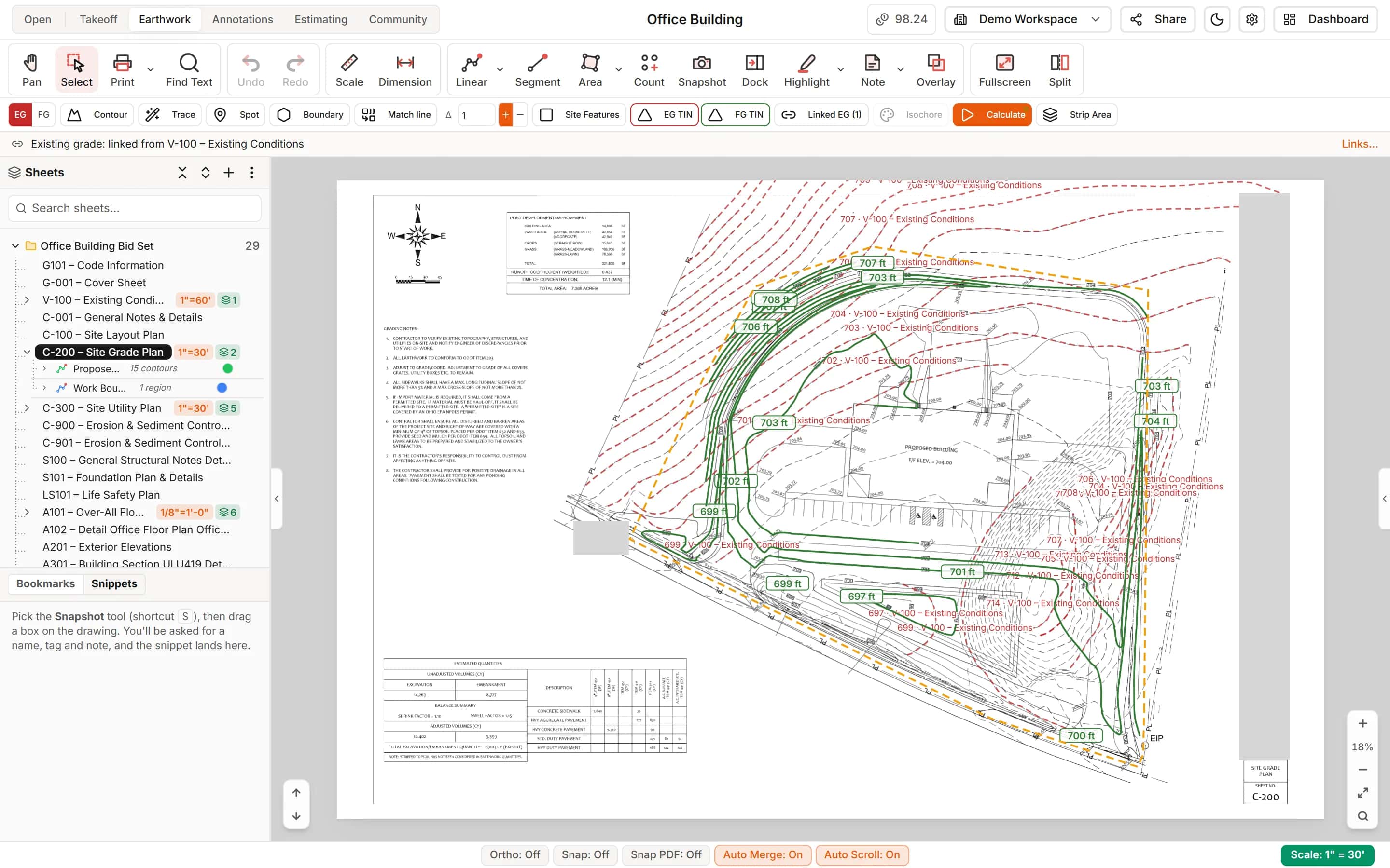
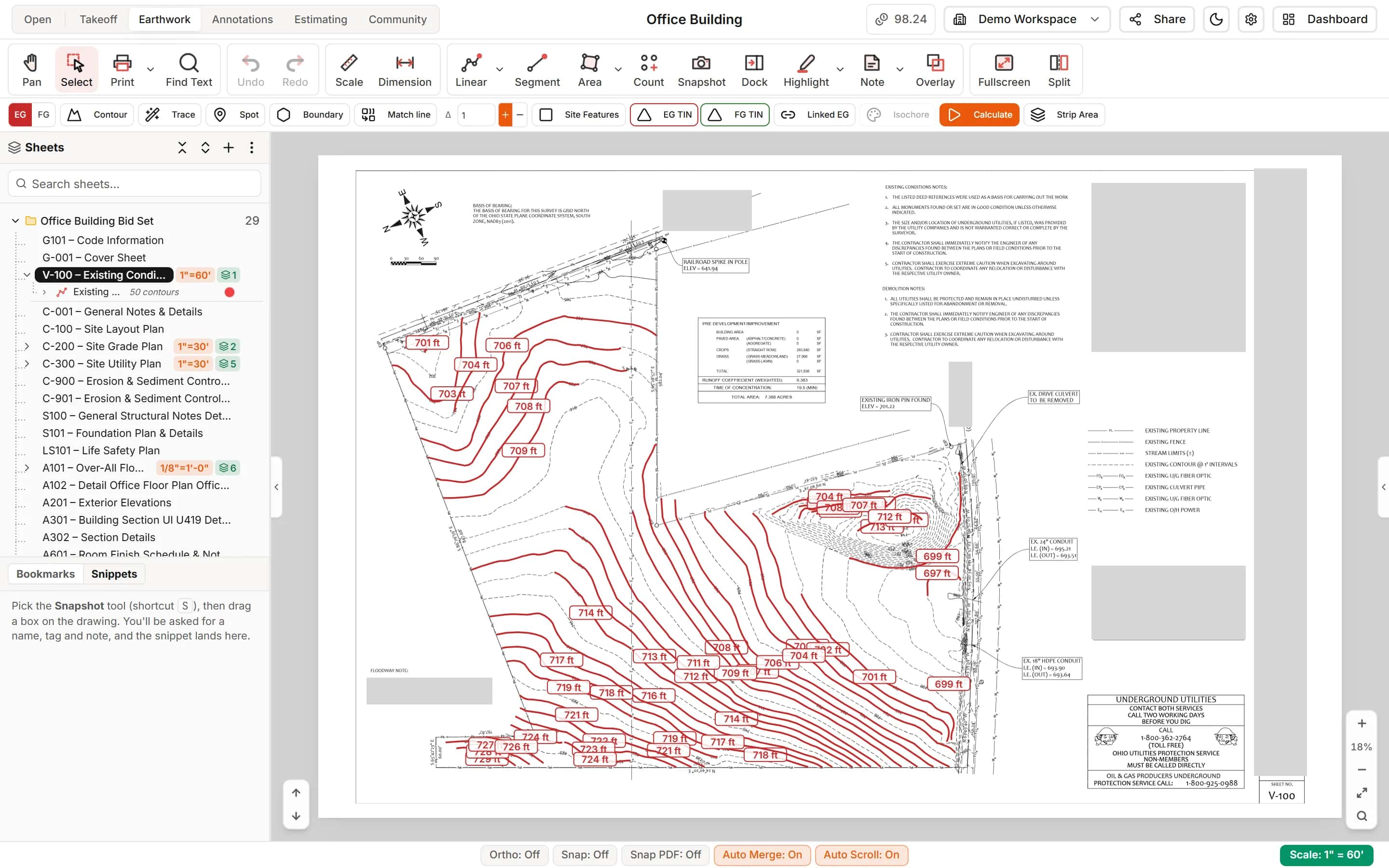
Cut and fill from the contours on the plans
Mark existing and proposed contours and spots, draw the work boundary and calculate. Site features lower the grade under pavement and slabs, and strip areas take the topsoil off first.
- Existing grade linked from the survey sheet
- Match lines join grading sheets into one site
Surfaces
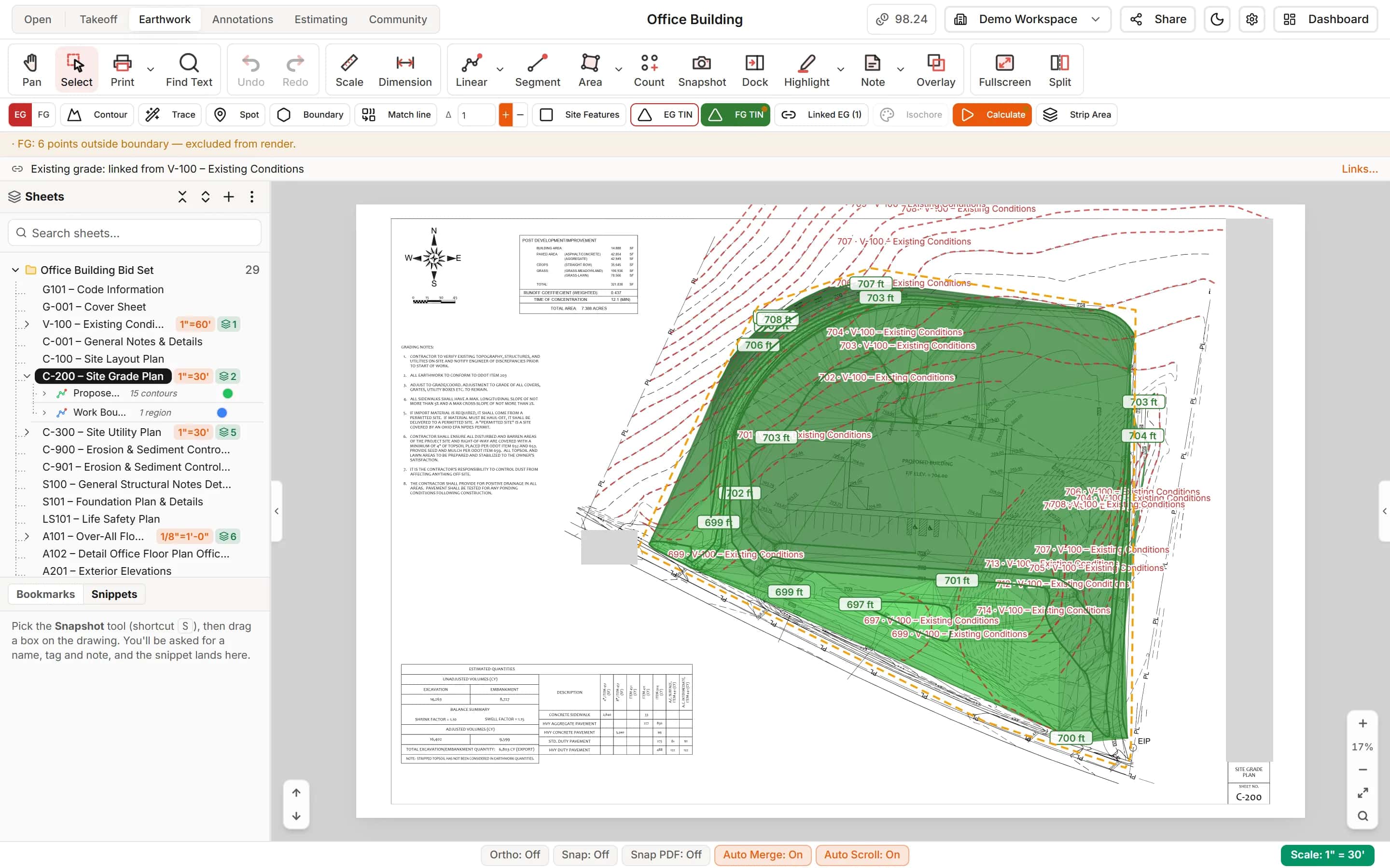
See the surfaces you are pricing
Existing and finished grade surfaces drawn over the sheet, so you can check the contours before you calculate. A contour or spot whose elevation does not fit its neighbours turns blue, so a typo is caught before it reaches your numbers.
- Contours, spots and boundary edited like any measurement
- Elevation check on every contour and spot

Paving and utilities
The rest of the site in the same takeoff
Measure paving areas, curb and pipe runs, and count structures on the same civil sheets, each filed under Divisions 31 to 33.
- Sub-items for base course and aggregate
- Earthwork lines in true bank, compacted and loose yards
Cut and fill
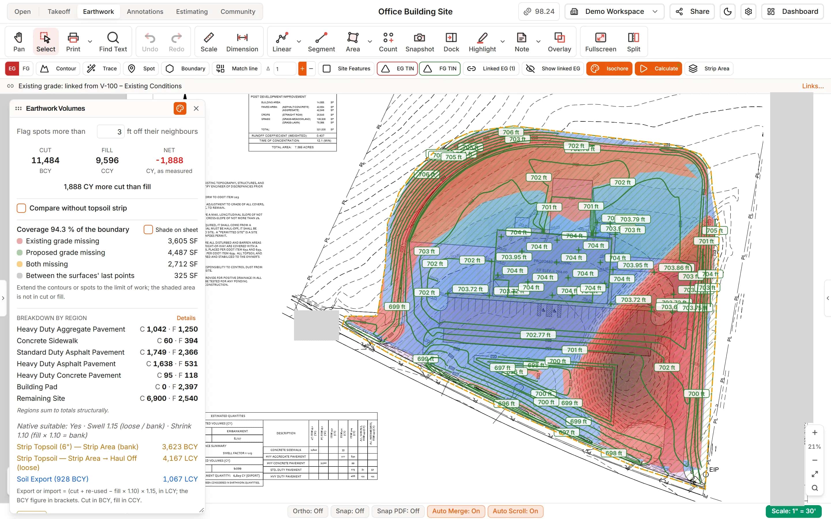
Cut, fill and net for the whole site
Calculate compares existing and finished grade inside the boundary. Join grading sheets at their match lines to get one balance for a site that spans several sheets.
- Shrink and swell entered as factors
- Soil export or import worked out for you
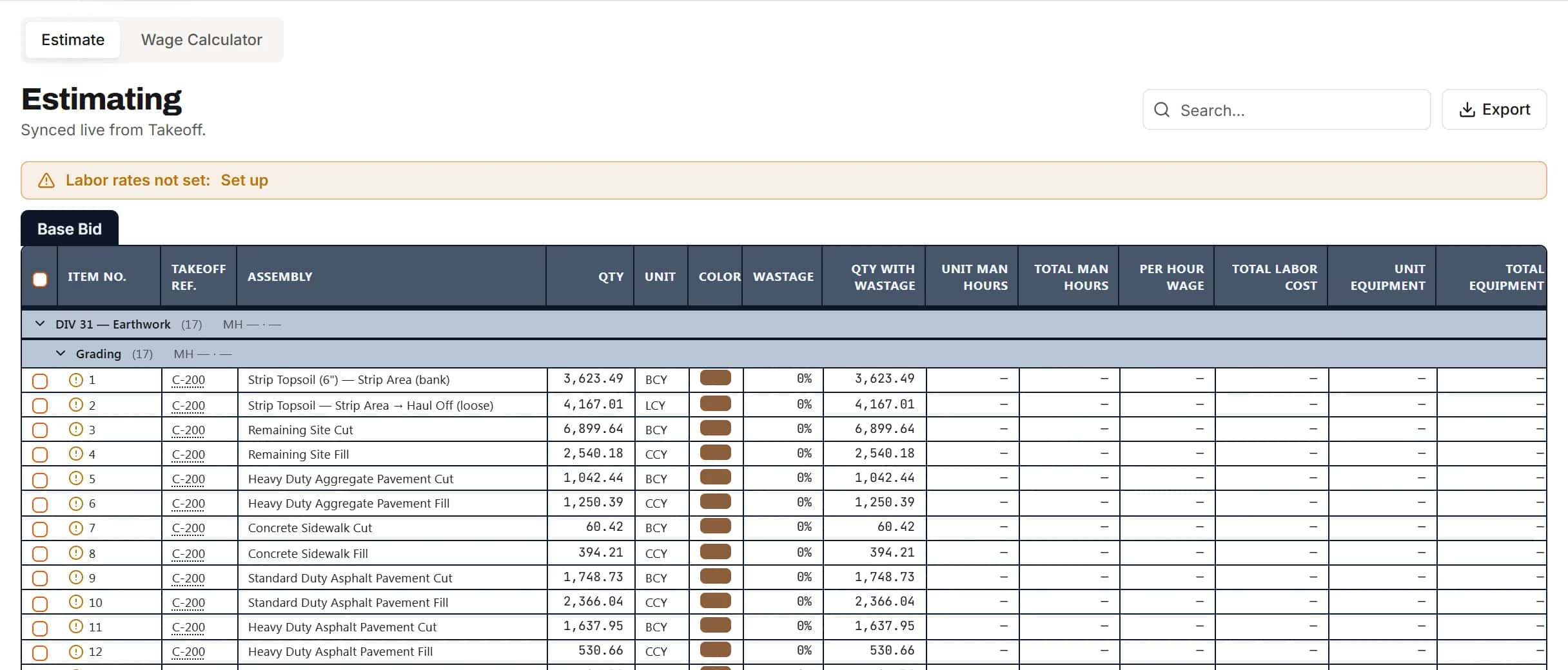
Division 31 lines
Earthwork priced like the rest of the job
Cut, fill, soil export, topsoil stripping, undercut and subgrade prep arrive as estimate lines in their true units, ready for your rates.
- Bank, compacted and loose yards where each belongs
- Exported to Excel with everything else
How it works
- 1
Trace the grades
Existing and proposed contours, spots and the boundary.
- 2
Calculate
Cut, fill and net, with site features and topsoil.
- 3
Price the site
Earthwork, paving and utilities in one estimate.
Frequently asked questions
Can I calculate cut and fill from PDF plans?
Yes. Contours and spot elevations on the PDF become existing and finished grade surfaces, and Calculate works out cut, fill and net inside the work boundary.
Does earthwork go into the estimate automatically?
Yes. Cut, fill, soil export or import, topsoil stripping, undercut and subgrade prep become estimate lines in Division 31.
What if the existing grade is on the survey sheet and the proposed grade on the grading plan?
Link the two sheets with matching control points. The calculation reads the existing grade from the survey sheet.
Can I measure paving, curb and pipe on the same sheets?
Yes. Linear, area and count work on civil sheets like any other, filed under Divisions 31 to 33.
Features for this work
- EarthworkExisting and proposed grade, cut and fill, site features and topsoil, straight into the estimate.Learn more
- TakeoffMeasure lengths, areas and counts on your plans, with every sheet at its own scale.Learn more
- EstimatingPrice every takeoff item with labor, material, equipment and sub quotes, up to the bid total.Learn more
- ClassificationsFile every item under CSI MasterFormat, UniFormat or NRM as you measure.Learn more
Bring your next bid set.
Upload the drawings, set the scale and measure your first item in the same sitting. Your projects live in the cloud, so the whole team opens the same set from any computer.
Start your free trial. No card required.