Earthwork
Earthwork takeoff software with cut and fill in the same project
Trace the existing and proposed contours, draw the work boundary and calculate. Cut, fill, topsoil stripping and subgrade work come out as estimate lines in Division 31, next to the rest of the job.
Start your free trial. No card required.
Existing and finished grade
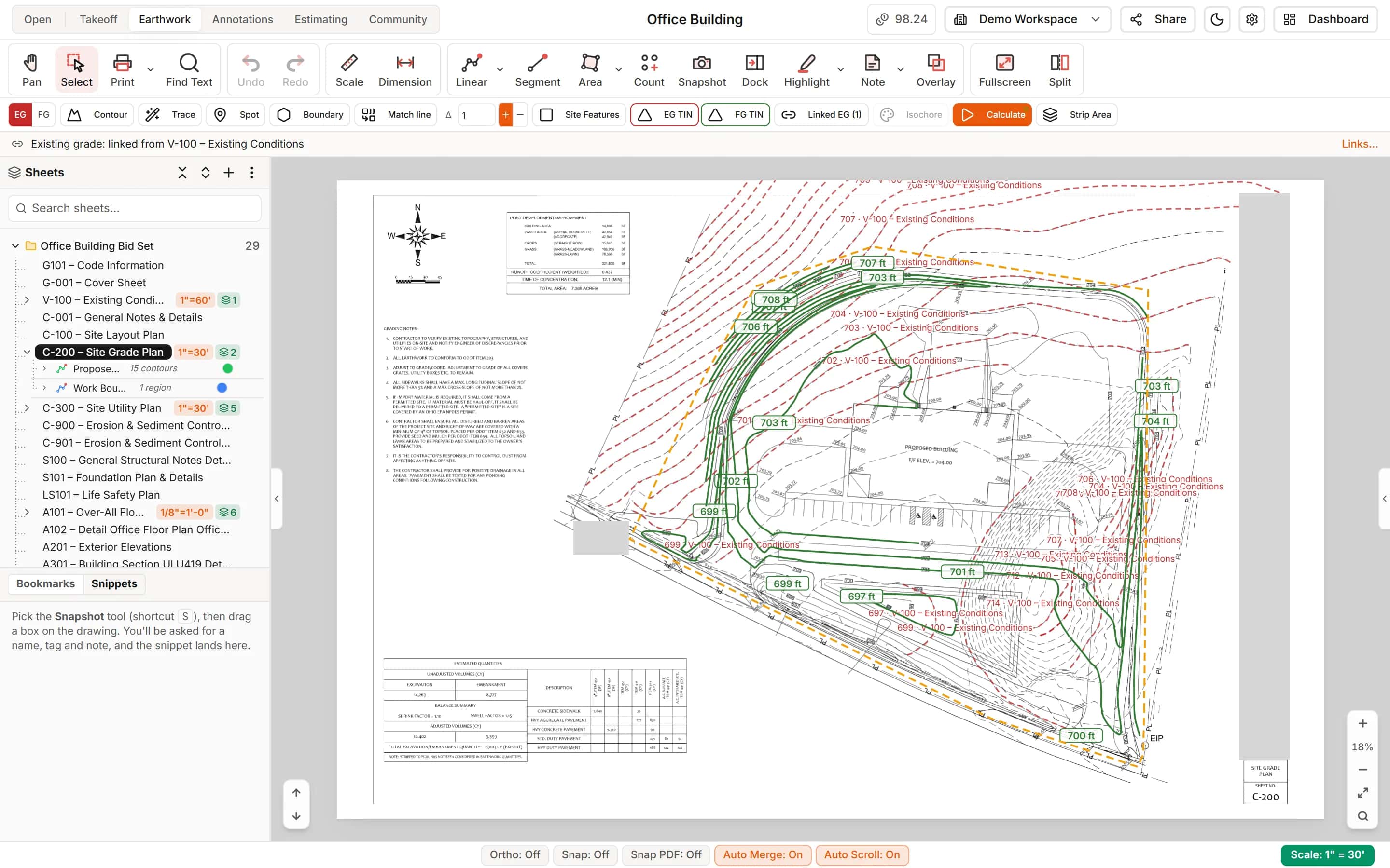
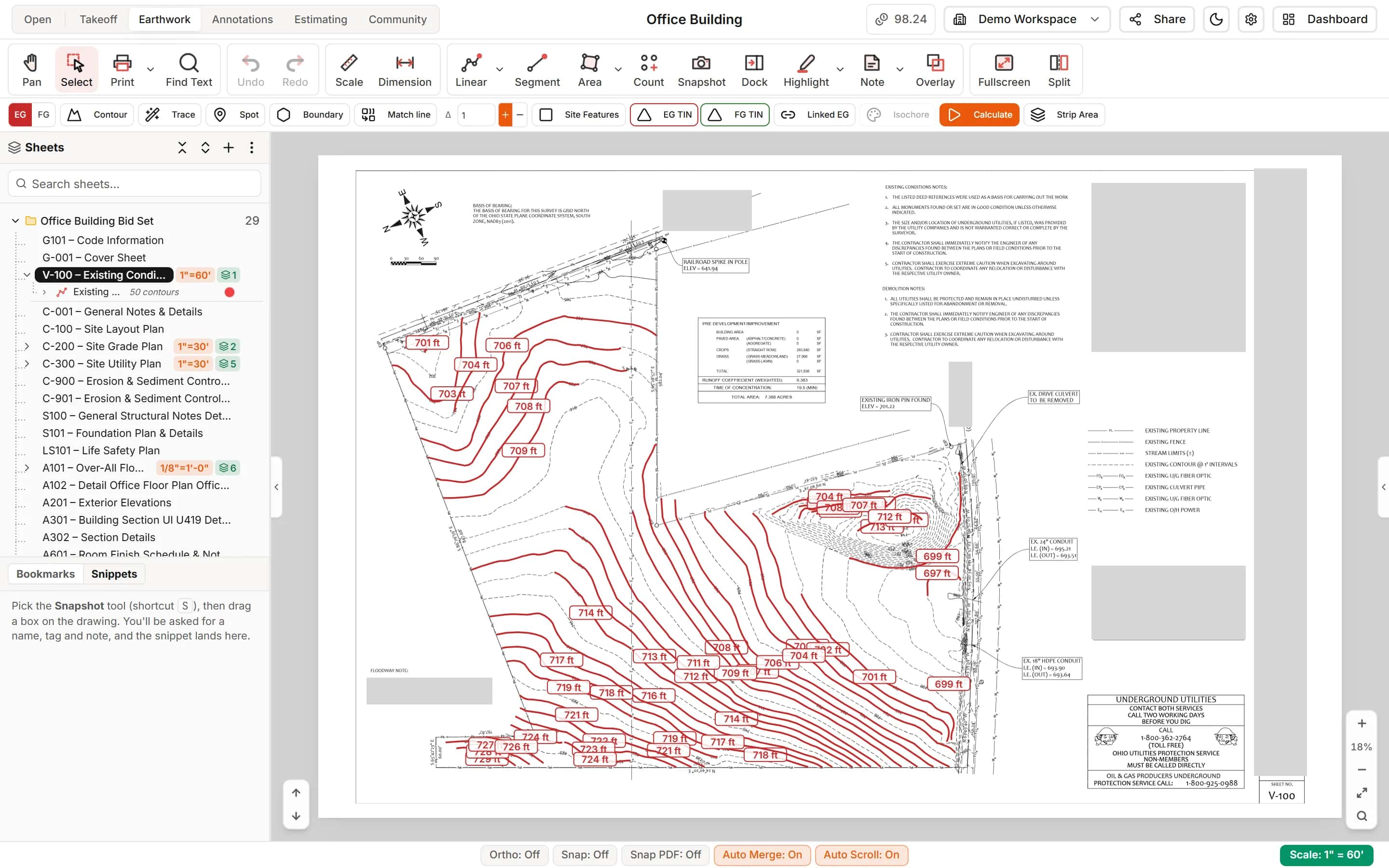
Surfaces from the contours already on the plans
Mark contours and spot elevations as existing or finished grade. Trace follows a printed contour for you, and contours with elevation labels can be adopted in one step.
- Contours, spots and a work boundary
- Trace and adopt labelled contours on vector sheets
- Edit contours like any other measurement
Existing grade from another sheet
Use the survey sheet's existing grade on the grading plan
When existing contours live on the survey and proposed contours on the grading plan, link the two sheets with a few matching points. The calculation reads the existing grade from the survey.
- Link sheets by clicking matching control points
- Existing grade shown on the grading plan as you work
Cut and fill
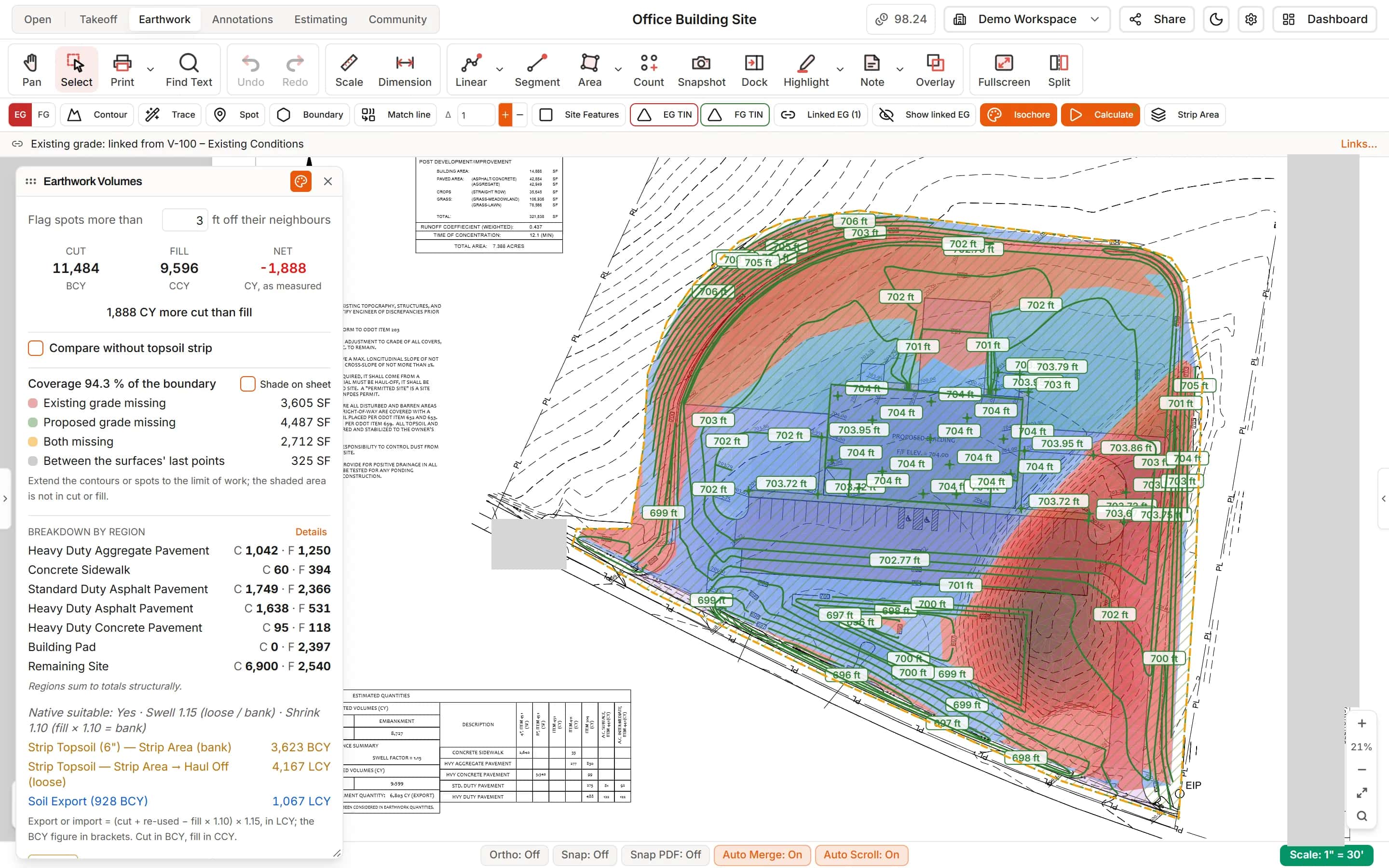
Calculate cut and fill between the surfaces
Calculate compares existing and finished grade inside the boundary and works out cut, fill and the net. Shrink and swell are typed as factors: shrink as how much more cut the fill needs, swell as loose over bank.
- Site Features lower the grade under pavement and slabs, with undercut and subgrade prep
- Strip Areas for topsoil that is hauled off, stockpiled or reused
- Match lines join grading sheets into one site with one balance
Check the surfaces
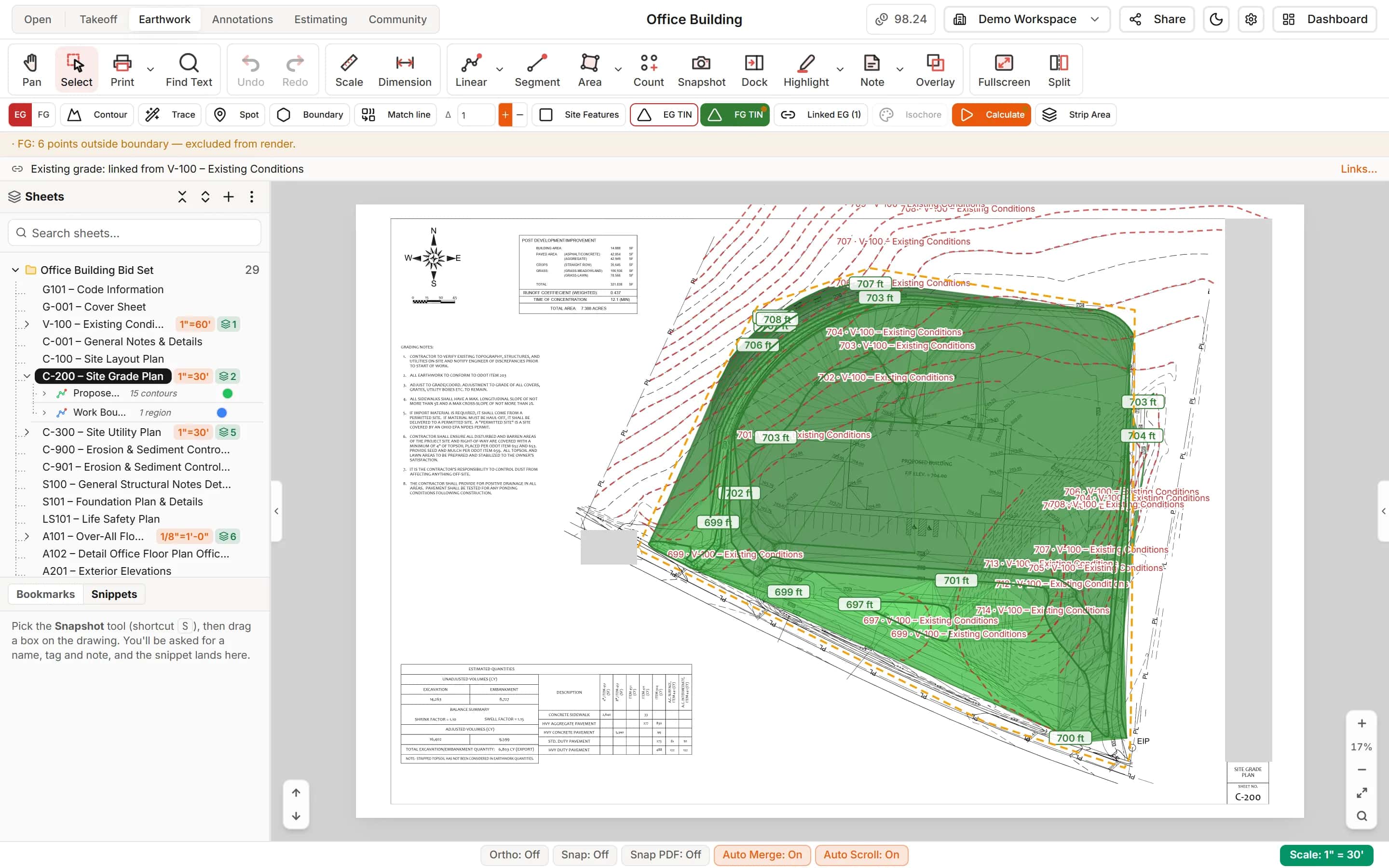
See the grade you are pricing
Show the existing or finished grade as a surface over the sheet and check the contours before you calculate. A wrong elevation stands out at a glance.
- Existing and finished grade surfaces
- Spot elevations where the contours are not enough
Elevation check
Catch elevation typos before they reach your numbers
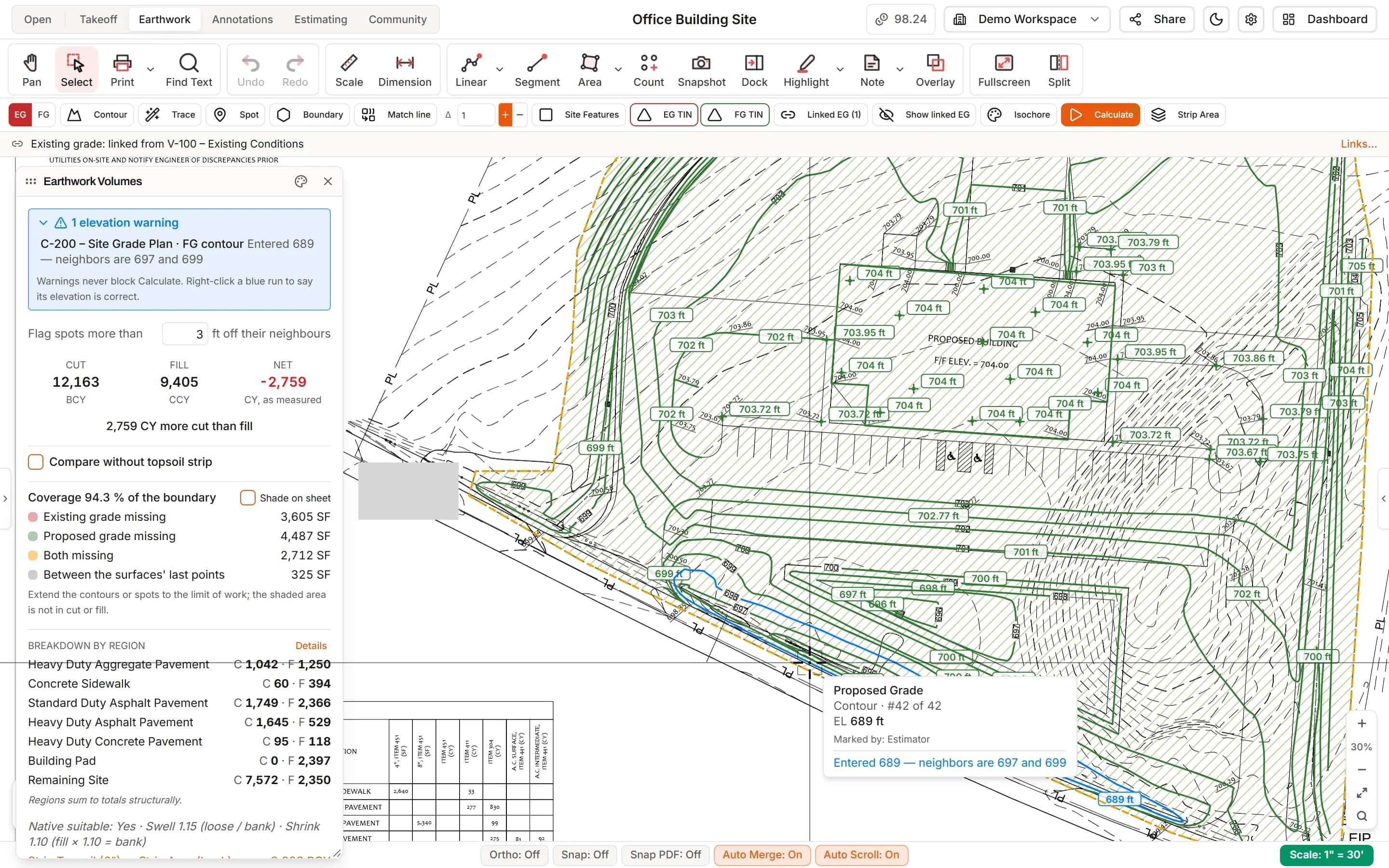
Every contour is checked against the contours on either side of it, and every spot against the grades around it. A 698 contour typed as 689 turns blue, and hovering it tells you why. Calculate lists each warning at the top of the Volumes panel, and a click takes you to the run.
- Contours checked against their neighbours as you enter them
- Spots checked against nearby grades, with a threshold you set
- Right-click a value that is correct to clear its warning
- Warnings never block Calculate
Compare without topsoil strip
Check against an engineer's table that leaves out stripping
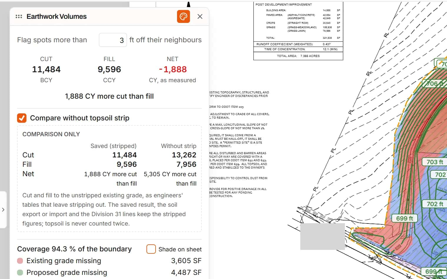
When the engineer's earthwork table leaves topsoil stripping out, turn on Compare without topsoil strip. The Volumes panel shows cut and fill to the unstripped existing grade beside your saved result. It is a view only: the soil export or import and the Division 31 lines keep the stripped figures, so topsoil is never counted twice.
- Saved and unstripped cut, fill and net side by side
- Each region's unstripped cut and fill in the breakdown details
- Nothing in the estimate changes
Coverage
See where the contours stop short of the boundary
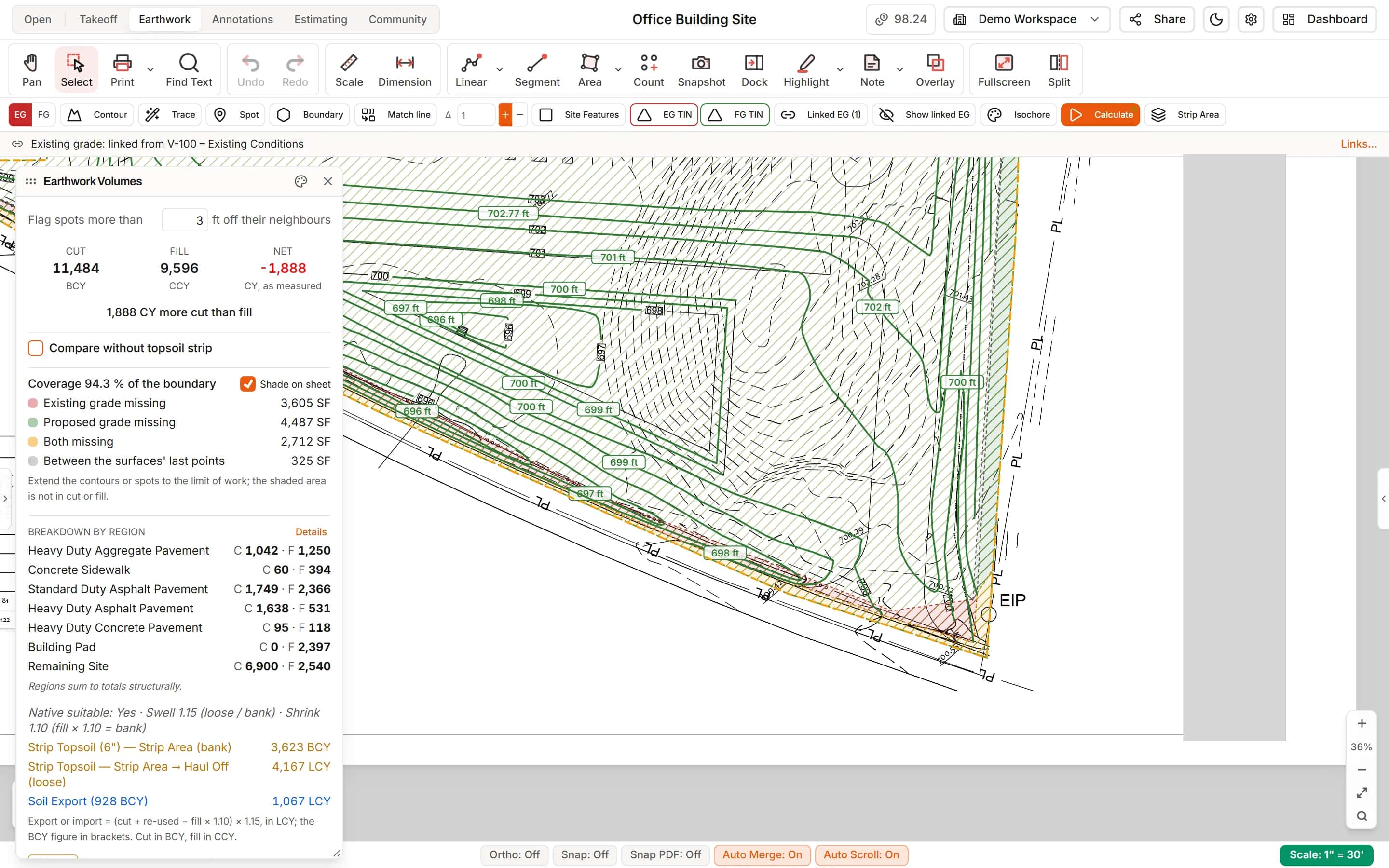
If the existing or proposed grade does not reach the work boundary, the Volumes panel says how much of the boundary is covered and what is missing there. Shade on sheet hatches those pieces on the drawing, so you know where to extend a contour or add a spot.
- Existing grade missing, proposed grade missing, or both, each with its area
- Each kind hatched in its own colour on the sheet
- The shaded area is left out of cut and fill, and the panel says so
Site Features
Pavement and slab sections, undercut and subgrade prep
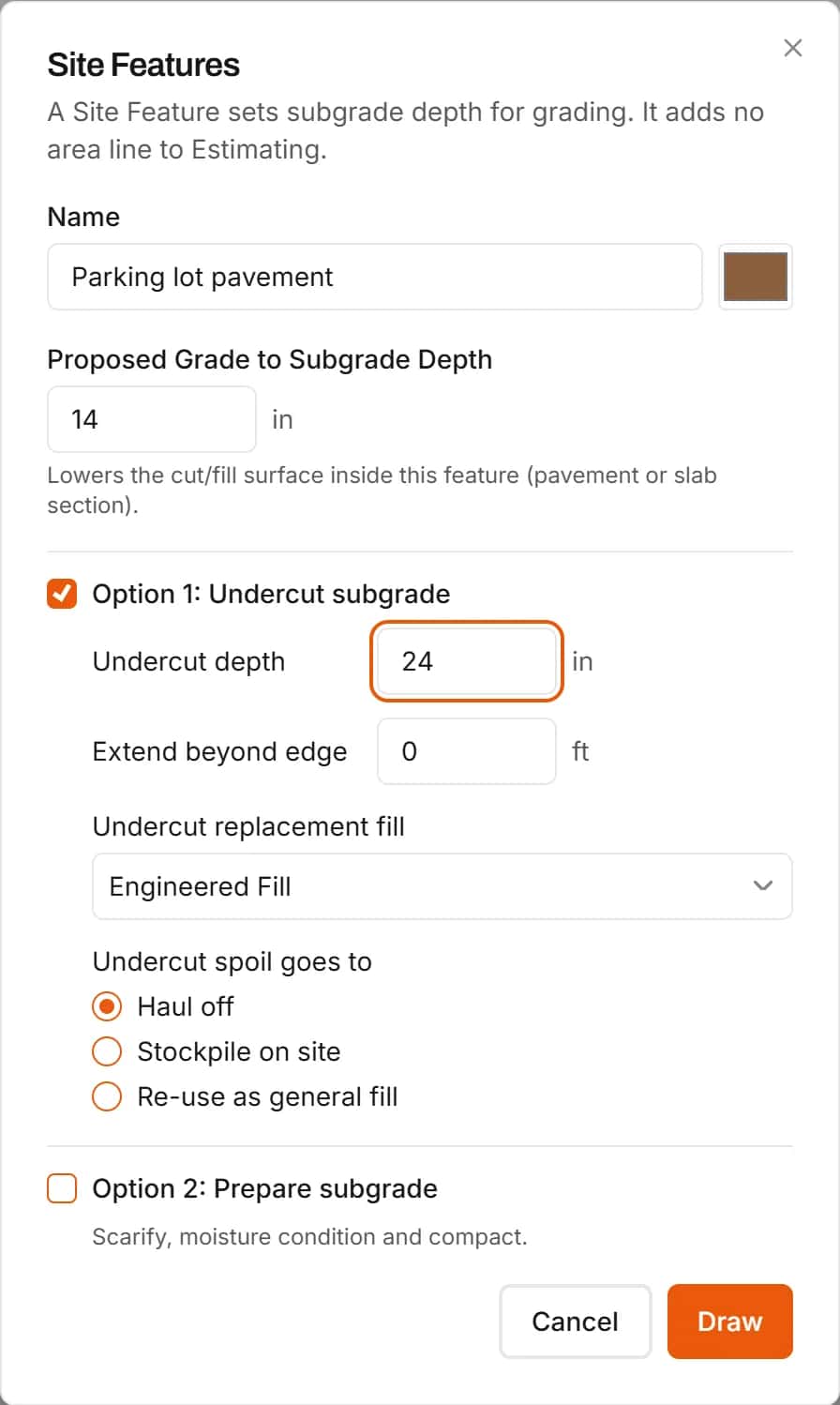
A Site Feature lowers the finished grade to subgrade under a parking lot or slab by its section depth, with undercut and replacement fill, and subgrade prep in lifts, where the soil needs it.
- Proposed grade to subgrade depth
- Undercut depth and replacement fill
- Prepare depth in lifts
Strip Areas
Topsoil off first, and sent where you say
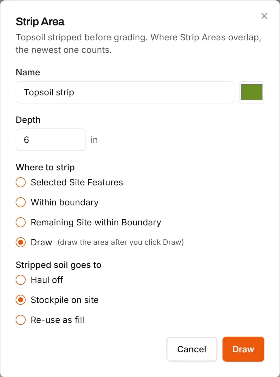
Draw a Strip Area with its depth and choose what happens to the topsoil: hauled off, stockpiled on site or reused as fill. The calculation accounts for it before cut and fill.
- Haul off, stockpile or reuse
- A Strip Topsoil line in the estimate
Straight into the bid
Earthwork lines land in the estimate
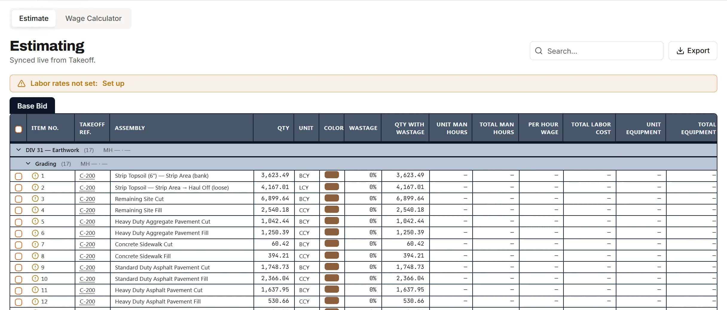
Cut, fill, soil export or import, topsoil stripping, undercut and subgrade prep become estimate lines, coded to Division 31, priced like any other line.
- Lines in their true units (bank, compacted and loose yards)
- Priced next to concrete, paving and utilities
How it works
- 1
Build the surfaces
Trace or draw existing and proposed contours and spots, and the work boundary.
- 2
Calculate
Get cut, fill and net, with site features and topsoil accounted for.
- 3
Price it
The volumes arrive as Division 31 lines in the estimate.
Frequently asked questions
Can I do cut and fill takeoff online?
Yes. The Earthwork tab builds existing and finished grade from contours and spot elevations on your PDF plans, calculates cut and fill inside the work boundary, and sends the results to the estimate.
What if the existing grade is on a different sheet from the proposed grade?
Link the survey sheet to the grading plan with matching control points. The calculation then reads the existing grade from the survey sheet.
Can a large site split across several grading sheets be calculated as one?
Yes. Join the sheets at their match lines and they work as one site, with one boundary, one calculation and one balance.
How do I enter shrink and swell?
As factors. Shrink is how much more cut each compacted yard of fill needs, for example 1.15. Swell is loose over bank, for example 1.25. If your geotechnical report gives shrink as a loss from bank, convert it first: factor = 1 / (1 - loss).
Does topsoil stripping come off before cut and fill?
Yes. Draw a Strip Area with its depth and say where the topsoil goes: hauled off, stockpiled on site or reused as fill.
Can I account for pavement and slab sections?
Yes. A Site Feature lowers the finished grade to subgrade by the section depth, with undercut and subgrade prep when you need them.
Will IntelCost flag a mistyped contour elevation?
Yes, when the value is out of line with its neighbours. Each contour is checked against the contours on either side and each spot against the grades around it. A value that does not fit turns blue with the reason, and Calculate lists every warning. If the value is right, right-click it and mark it correct.
The engineer's earthwork table leaves out topsoil stripping. How do I compare?
Turn on Compare without topsoil strip in the Volumes panel. It shows cut and fill to the unstripped existing grade beside your saved result. The saved result, the soil export or import and the Division 31 lines keep the stripped figures, so topsoil is never counted twice.
What happens where the contours do not reach the work boundary?
That area is left out of cut and fill. The Volumes panel shows how much of the boundary is covered and what is missing, and Shade on sheet marks those pieces on the drawing so you can extend the contours or add spots.
Learn more
Guides for the work behind this feature, useful whatever software you use.
- GuideCut and Fill Explained for EstimatorsHow cut and fill volumes are found, and how bank, loose and compacted yards, shrink and swell decide whether a site imports or exports.Read the guide
- GuideSitework Estimating Basics: From Clearing to PavingWhat sitework covers, how to break it into takeoff items with the right units, the order it is built in, and the items that are easy to miss.Read the guide
Related features
- TakeoffMeasure lengths, areas and counts on your plans, with every sheet at its own scale.Learn more
- EstimatingPrice every takeoff item with labor, material, equipment and sub quotes, up to the bid total.Learn more
- ClassificationsFile every item under CSI MasterFormat, UniFormat or NRM as you measure.Learn more
- CollaborationYour whole team on the same project in real time, with annotations and comments for reviewers.Learn more
Bring your next bid set.
Upload the drawings, set the scale and measure your first item in the same sitting. Your projects live in the cloud, so the whole team opens the same set from any computer.
Start your free trial. No card required.